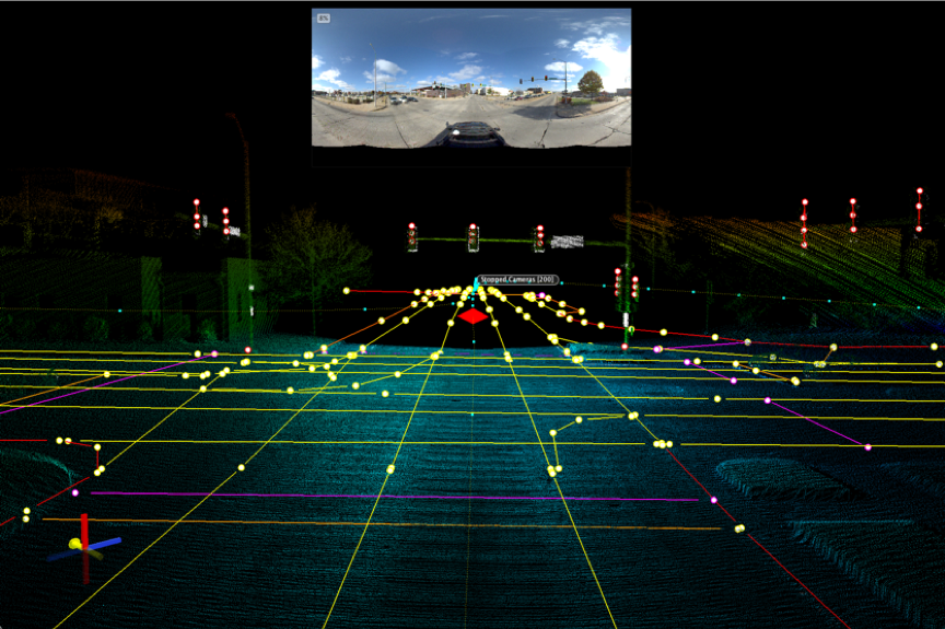
Mandli delivered the first Highly Automated Driving (HAD) Map to a client for testing autonomous vehicles (AVs). What sets Mandli apart in HAD map development is our ability to create customized maps for any given location.
Category: History Event
Used the events in the home page history area.
NCAT Certification
In 2019, Mandli achieved the unique distinction of being the first technology company to get its data collection vehicle certified at the National Center for Asphalt Technology (NCAT) for two of its pavement scanning systems, LCMS-1 and LCMS-2.
X35 Data Collection Vehicle
Mandli introduced its newest Data Collection Vehicle, the X35 in 2018. Equipped with the latest technology for pavement scanning and LiDAR for asset information, the X35 comes with 9 cameras, each with a resolution of 80 megapixels per image, at rates up to 500 frames per mile, and provides 360-degree image coverage.
History event- Milestones
- 100,000+ miles of roadway scanned
- 215+ terabytes of data collected
- 1,110,000+ assets extracted
History Event – Maverick
In 2016, Mandli introduced the Maverick, an ultra-portable mobile mapping system that combines high-resolution 360º imaging, high-definition LiDAR, and an integrated position and orientation system, to provide a robust and multi-functional dataset.
History Event – 3D pavement profiling with the LCMS
In 2012, Mandli made the switch from 2D to 3D pavement profiling with the LCMS. This increased accuracy and allowed for the development of automated distress.
History Event – Milestones
- 150,000 Miles Collected
- 1,000,000 Assets Extracted
- First solid model from LiDAR used in a commercial
History Event – Began using Mobile LiDAR
In the pursuit for better asset inventory and vertical clearance measurements, Mandli came upon Velodyne LiDAR. Mandli integrated Velodyne LiDAR to create high-resolution 3D pointclouds, which gave the ability to identify and extract a wide variety of assets, and perform horizontal and vertical clearance measurements in one pass of the collection vehicle.
History Event – Developed Linescan Pavement Imaging System
Up until this point, pavement distress was collected via windshield survey or area scan cameras pointed down at the pavement. To get a better view of the pavement, Mandli developed the linescan system, which integrated two linescan cameras with laser illumination, allowing for continuous pavement imaging.
History Event – Two Point Vertical Clearance System
Leading up to 2004, there was a big push in the industry for accurate bridge permitting. Mandli began using a three-laser system (one pointed at the pavement, two pointed up to the overhead structure) to measure vertical clearances.